Exploring New York State Transport
Master the diverse ways to travel across New York State, from urban subways to scenic drives and regional rails.

Navigating New York State offers a variety of options tailored to its vast landscapes, from the bustling streets of New York City to the serene countryside upstate. Whether you’re zipping through urban hubs or venturing to rural retreats, understanding the transportation network ensures smooth travels. This guide covers essential methods, costs, tips, and tools to help you move efficiently across the Empire State.
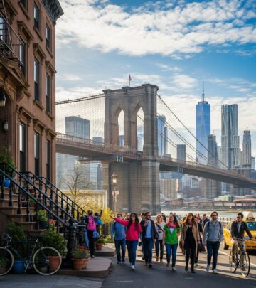
Urban Transit in the Heart of NYC
New York City’s public transportation system stands as one of the world’s most extensive, serving millions daily with reliable subway and bus services operated by the Metropolitan Transportation Authority (MTA). The subway network spans four boroughs—Manhattan, Brooklyn, Queens, and the Bronx—providing 24/7 access to key attractions, neighborhoods, and airports.
Subway fares are a flat $3 per ride, allowing unlimited transfers between lines without exiting turnstiles. Use contactless payment via OMNY for seamless entry, or purchase MetroCards at kiosks. Express trains like the 4 and 5 skip stops for faster commutes, while local options such as the 6 serve every station—ideal for shorter hops. Buses complement the system, running frequently (every 5-15 minutes daytime) with similar $3 fares and two-hour transfer windows to subways.
- Pro Tip: Download the MTA app for real-time schedules, service alerts, and station maps to avoid delays.
- Peak hours (7-9 AM, 5-7 PM) bring crowds; opt for off-peak for comfort.
- Staten Island lacks subway service—use the free Staten Island Ferry or local railway (SIR) from St. George to Tottenville.
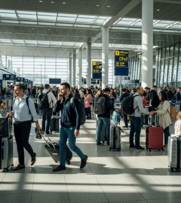
Regional Rail Connections Beyond the City
For trips outside NYC, commuter rails like Metro-North and Long Island Rail Road (LIRR) link suburbs and upstate destinations. Metro-North departs from Grand Central Terminal, reaching Poughkeepsie, Hudson Valley spots, and lines to Wassaic via Harlem, Hudson, and Port Jervis branches. LIRR from Penn Station serves Long Island communities.
PATH trains connect NYC to New Jersey hubs like Newark and Hoboken from stations including World Trade Center and 33rd Street. Amtrak provides intercity service statewide, ideal for longer hauls to Buffalo or Albany. Tickets vary by distance; buy via apps or stations for peak/off-peak discounts.
| Service | Main Hubs | Key Routes | Fare Example (One-Way) |
|---|---|---|---|
| Metro-North | Grand Central | Harlem/Hudson Lines to Poughkeepsie | $15-30 |
| LIRR | Penn Station | Long Island to Montauk | $10-25 |
| PATH | WTC, 33rd St | To NJ (Hoboken/Newark) | $2.75 |
Transfers between Grand Central and Penn Station are straightforward: take uptown 1/2/3 subway to Times Square, then the S shuttle.
Ferries and Waterways for Scenic Rides
New York’s waterfront location makes ferries a delightful, often free option. The iconic Staten Island Ferry runs 24/7 from Whitehall Terminal, offering 25-minute cruises past the Statue of Liberty—perfect for sightseeing at no cost. NYC Ferry services cover Manhattan, Brooklyn, Queens, and beyond, with fares around $4 and frequent departures.
NY Waterway ferries link Manhattan (Midtown West, Brookfield Place) to New Jersey, operating daily with free shuttle buses to terminals. Roosevelt Island Tram provides aerial views across the East River for $3, free for kids under 44 inches with adults. These routes serve over 2 million riders yearly, blending commute and leisure.
Ride-Hailing, Taxis, and Shared Mobility
For flexibility, yellow taxis and app-based services like Uber and Lyft are ubiquitous. Hail lit-roof taxis curbside; fares start at $3 plus mileage, with surcharges like $2.50 for Manhattan congestion south of 96th Street. Multiple stops are allowed without extra fees beyond meter time.
Ride-shares offer E-hail via apps, competitive for groups or late nights. Hotel doormen assist for a $2-5 tip. Specialized options like Kid Car provide child seats for families. Pedicabs and horse carriages add fun in Central Park, though pricier for short joyrides.
Cycling and Micromobility Innovations
Biking thrives with Citi Bike stations citywide—unlock via app for $4.99/30 minutes or daily passes. Revel mopeds offer electric rentals for zipping through traffic. NYC DOT maintains protected bike lanes, safest during daylight. Upstate, trails like the Erie Canal Path suit scenic pedaling.
- Always wear helmets; lock bikes securely.
- Combine with transit: bikes fold for subways (off-peak).
Driving Across the Empire State
While NYC driving challenges with traffic and parking ($30-60/night), it’s viable upstate. Use I-87 (Thruway) for Albany, I-90 to Buffalo. NYSDOT oversees highways, bridges, and ferries statewide. Apps like Google Maps or Waze guide around congestion; E-ZPass speeds tolls.
Rentals available at airports; gas stations plentiful. Winter tires recommended for snow-prone areas. Major bus lines like Greyhound or Megabus connect cities affordably.
Planning Tools and Accessibility
Official sites like iloveny.com list statewide options. MTA.info covers NYC transit; 511NY app provides real-time statewide updates. Accessible services include low-floor buses, elevator-equipped stations, and paratransit.
For families, trams and ferries offer kid perks. International visitors: get a Visitor Oyster-like OMNY setup.
Frequently Asked Questions
What is the cheapest way to get around NYC?
Subway or bus at $3/ride with transfers; walking for short distances.
Does public transit run 24/7?
Yes, subways and many buses operate around the clock.
How do I get to Staten Island?
Free ferry from Whitehall or SIR railway.
Are bikes allowed on subways?
Yes, off-peak in designated cars.
What’s the best app for NY State travel?
MTA, 511NY, or Google Maps.
Sustainable Travel Choices
Opt for transit to cut emissions—MTA moves millions eco-friendly. Ferries and bikes enhance green adventures across the state.
References
- How to Navigate Public Transportation in New York City — New England Parisienne. 2026-01-16. https://newenglandparisienne.com/2026/01/16/nyc-public-transportation-guide/
- Navigating NYC | Your Guide to Subway, Buses & Ferries — NYC Tourism. Accessed 2026. https://www.nyctourism.com/getting-around/
- 10 Types of NYC Public Transportation | How to get around New York — YouTube (Video). Accessed 2026. https://www.youtube.com/watch?v=F5uH2Z0ak4c
- Getting Around New York State | Transportation Options — I Love NY. Accessed 2026. https://www.iloveny.com/travel-tools/transportation/
- New York City Department of Transportation (NYC DOT) — NYC.gov. Accessed 2026. http://nyc.gov/dot
Similar Articles


Read full bio of Sneha Tete


