High Uintas Wilderness: 545-Mile Trails & Backpacking Guide
Discover the vast alpine wonders, epic trails, and pristine lakes of Utah's largest wilderness area in the Uinta Mountains.

The High Uintas Wilderness stands as Utah’s premier untamed expanse, encompassing 453,900 acres of pristine alpine terrain in the heart of the Uinta Mountains. This vast region, the largest wilderness area in the state and more than three times bigger than the next largest, offers unparalleled opportunities for immersion in nature, from high-elevation tundra to dense forests and crystal-clear lakes.
Unveiling the Landscape and Geological Marvels
Nestled in northeastern Utah, the High Uintas form the only major east-west trending mountain range in the lower 48 states, stretching across the Uinta-Wasatch-Cache and Ashley National Forests. Named after the Uintaat Indians, ancestors of the Ute Tribe, these peaks rise dramatically, culminating in Kings Peak at 13,528 feet—the highest point in Utah. The area boasts the largest contiguous alpine tundra in the central Rockies, with lower elevations cloaked in lodgepole pine, spruce, and subalpine fir forests.
This rugged domain features flat-topped mountains, rushing streams, and over 1,000 lakes, many stocked with brook and cutthroat trout. The wilderness’s primitive and semi-primitive non-motorized settings ensure a nearly untouched natural environment, designated by Congress in 1984 under the Utah Wilderness Act and the 1964 Wilderness Act. Coordinated management between the two national forests, led by Ashley, emphasizes preservation through the 1997 High Uintas Wilderness Management Plan.
Access Points and Trail Networks
Reaching the High Uintas is straightforward from Salt Lake City, about two hours east via the scenic Mirror Lake Highway for day-use spots like fishing or paddling. For deeper adventures, 16 developed trailheads encircle the area near gateway towns such as Duchesne, Roosevelt, Kamas in Utah, and Evanston, Mountain View in Wyoming. Expect a mix of paved and gravel roads adding up to three hours each way for remote starts.
An extensive 545-mile trail system beckons explorers through thick woodlands, past cascading waters, serene ponds, and panoramic alpine vistas beneath towering summits. No motorized vehicles, bikes, or mechanized gear allowed—only foot, horse, or pack animal travel preserves the solitude.
- Primary Trailheads: Eastern accesses like McKee Draw for the iconic Highline Trail; western entries near Hayden Pass.
- Mirror Lake Highway: Ideal for casual outings with roadside lakes and short hikes.
- Northern and Southern Approaches: Gravel roads leading to trailheads for multi-day treks.
Signature Adventures: Backpacking and Thru-Hiking
Backpackers find paradise here, with extended trips possible due to the immense scale—options for loops, out-and-backs, or the legendary 101-mile Uinta Highline Trail from McKee Draw to Hayden Pass. A popular variant skips the initial 21 miles of meadow trekking, starting at Leidy Peak for an 80-mile journey.
Trails wind at elevations often exceeding 10,000 feet, offering sweeping views of bald peaks like Bald Peak and Reeds, sentinels over vast basins. Solitude reigns, with reports of multi-day trips encountering no other humans amid soft sands, thin pines reminiscent of Arizona highlands, and utter silence. The Highline challenges with weather shifts, wet fields, and steep climbs but rewards with introspection, starry skies, and abundant trout fishing.
| Trail | Length | Difficulty | Highlights |
|---|---|---|---|
| Uinta Highline Trail | 101 miles | Strenuous | Alpine vistas, lakes, Kings Peak access |
| Leidy Peak Start (Highline variant) | 80 miles | Strenuous | Peak views, reduced meadow sections |
| Rock Creek Circumnavigation | Varies (multi-day) | Moderate-Strenuous | Lakes loop, family-friendly options |
Wildlife, Fishing, and Natural Wonders
Anglers thrive with over 500 stocked lakes teeming with brook trout rivaling salmon in flavor. Wildlife viewing includes moose, elk, deer, and birds in diverse habitats from tundra to streams. Hunting seasons apply, alongside opportunities for rock climbing and peak bagging.
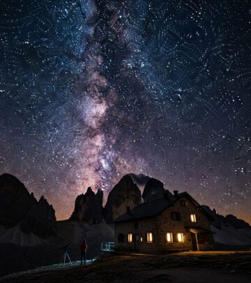
Fragile high-elevation basins demand careful treading to protect alpine ecosystems, where sheep grazing persists under grandfathered permits. The Milky Way dazzles in low-light pollution skies, enhancing nighttime camps.
Essential Gear and Preparation Tips
High-altitude exposure requires robust preparation: layered clothing for rapid weather changes, bear-proof food storage (no grizzlies, but black bears present), water purification for streams and lakes, and navigation tools as cell service vanishes.
- Packing Essentials: Lightweight tent, sleeping bag rated to 20°F, stove, first-aid kit, map/compass/GPS.
- Permits: Free self-issue at trailheads; group sizes limited to 14 (7 for horses).
- Seasonal Notes: Prime July-September; snow lingers into July on high passes.
Horse packing suits stock users, with extensive trails accommodating. Dogs allowed on leash, but pack out all waste.
Preserving the Wilderness Legacy
National drawing power underscores the need for Leave No Trace principles: camp 200 feet from water, bury human waste, minimize campfire impacts. Ongoing concerns like grazing in sensitive areas highlight conservation efforts.
The 1984 designation and 1997 plan ensure sustained wild character, balancing recreation with ecological integrity.
Day Trips and Family-Friendly Options
Not all visits demand multi-day commitments. Mirror Lake Highway offers canoeing, paddleboarding, and short hikes to stocked waters. Families or novices can tackle 5-10 mile out-and-backs to lakes, blending accessibility with wilderness flavor.
Gateway Communities and Logistics
Stock up in Duchesne, Roosevelt, Kamas, Evanston, or Mountain View for supplies, lodging, or guides. Campgrounds dot approaches; wilderness sites are dispersed.
FAQs
What is the best time to visit the High Uintas Wilderness?
July through September provides snow-free trails and mild weather, though afternoons bring thunderstorms.
Are permits required for backpacking?
Free self-registration at trailheads; no advance permits needed, but quotas may apply during peak season.
Can I bring my dog?
Yes, leashed dogs permitted; pack out waste.
Is fishing allowed, and what species?
Yes, with Utah license; brook and cutthroat trout abundant in 500+ stocked lakes.
How do I summit Kings Peak?
From trailheads like Henrys Fork, ~26-30 miles round-trip; class 2 scrambling.
Why Choose High Uintas for Your Next Adventure
This under-the-radar gem delivers raw beauty, challenge, and seclusion unmatched in Utah. Whether chasing peaks, reeling trout, or seeking silence, the High Uintas transforms ordinary trips into profound escapes.
References
- Help protect fragile, high elevation alpine basins in the High Uintas — Wilderness Watch. Accessed 2026. https://wildernesswatch.salsalabs.org/highuintasgrazing
- This corner of northeastern Utah is the wilderness only locals know — Lonely Planet. Accessed 2026. https://www.lonelyplanet.com/articles/high-uintas-wilderness-utah
- Ashley National Forest | High Uintas Wilderness — US Forest Service. Accessed 2026. https://www.fs.usda.gov/r04/ashley/recreation/high-uintas-wilderness
- Uinta Highline: The Struggle and the Strength — The Trek. Accessed 2026. https://thetrek.co/uinta-highline-the-struggle-and-the-strength/
- Tall and Lonely: Backpacking Utah’s High Uintas Wilderness — The Big Outside. Accessed 2026. https://www.thebigoutside.com/tall-and-lonely-backpacking-utahs-high-uintas-wilderness/
Similar Articles


Read full bio of Sneha Tete